Construction
USING DRONES FOR YOUR CONSTRUCTION
The biggest industry in the world is construction. Productivity growth has been slow, projects don’t achieve their budget nor their deadlines. Skilled workers are becoming hard to find.
Drone data has many different aspects or features in the industry and are useful throughout the construction cycle. Drones offer solutions to monitor progress, improve safety, reduce re-construction, and can reduce costs and time.

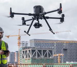
Drones allow you to collect data quickly, easily and cost effectively and allowing project teams detailed, accurate topographic surveys. This allows Architects and engineers to reference the data during the development.


D.A.S provides detailed maps of the entire project to site managers to avoid mistakes before they happen, avoiding costly re-construction and therefore remain on schedule and within budget. With quality aerial imaging and real time video, inspectors can evaluate from the ground with little risk.
We can also offer survey quality images, lidar images and thermal images as well as supply Digital twins which can be continually updated with a virtual representation of the real-world construction site. Digital twins are invaluable for planning and making decisions.
BIM (Building information modelling) models can be visualized with 3D models created from the drone data.
Building inspections carry risk and require teams to walk across possible dangerous roof tops and sites, but drones can acquire the data quickly and safely for an inspection.