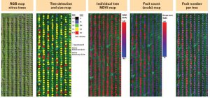
D.A.S in conjunction with UAV Images integrate crop images into their software, Crop Manager.
D.A.S use drones to capture images, rather than fixed wings which are expensive to hire, and then convert the image into data. This data gives the farmer a number of advantages:
Crop Status includes – Counting germinated crops for a more accurate yield outcome can be taken at different growing stages
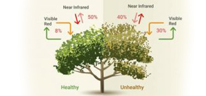
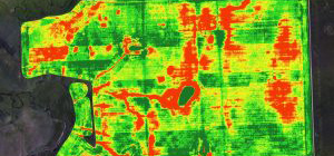
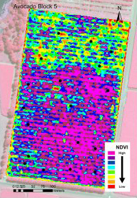
Identifying health of the crop – disease is identified early
Weed eradication
Canopy profiling
Plant evaluation and replanting
Water quality / drainage
Correct fertilization
Identifying correct concentration of chemicals in the soil (nitrogen)
Identify wildlife that may consume / destroy crops